Historical mystery author Ana Brazil champions the visual value of vintage postcards.
###
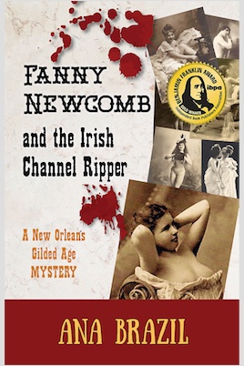
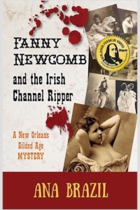
 Relevant History welcomes back Ana Brazil, a longtime student of history and a voracious reader of mystery. Her historical mystery novel and short stories feature brash American heroines, the more bodacious the better. Ana’s debut novel, Fanny Newcomb and the Irish Channel Ripper, won the 2018 IBPA GOLD Medal for Historical Fiction. Her current work-in-progress features a vaudevillian-chanteuse-who-knows-too-much set in 1919 San Francisco. Ana is an active member of Sisters in Crime and the Historical Novel Society, and a founding member of the Paper Lantern Writers Collective of historical fiction writers. To learn more about Ana and her fiction, visit her web site, and follow her on Facebook, Twitter, Instagram, Pinterest, and Goodreads.
*****
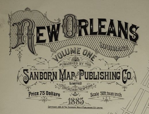
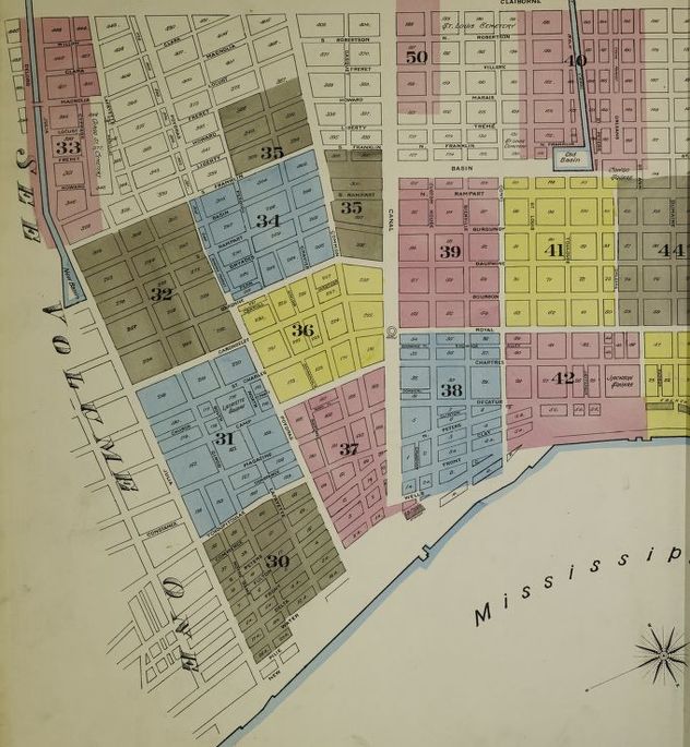
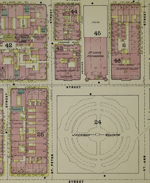
In an earlier Relevant History post, I shared my long-standing love of Sanborn Fire Insurance maps, which I used extensively in my research of Gilded Age New Orleans. Today I’m sharing my fascination with Turn-of-the-Century-and-slightly-beyond postcards. Or as I call them, “the best hold-it-in-your-hand-history ever.”
Many, many historians have detailed the history of postcards much better than I could ever hope to, but I will share these two first facts: the first known postcard was sent through London in 1840 and the first known American postcard was sent in December 1848.
From those 19th-century dates, postcards made a slow but steady ascent into the lives of mail-sending people across the globe. Postcards reached their Golden Age during the years 1907-1913-ish when postcards were produced, sold, sent, and collected at an astounding rate.
 Fortunately for all, the Golden Age of postcards intersected with the turn-of-the-century City Beautiful movement (a concerted effort to enhance the appearance of American towns and cities) and with the advent of automobile-inspired tourism. As a result, postcards of the Golden Age showed off the best and brightest of a city’s civic buildings, parks, churches, residences, and commercial areas. And don’t forget the cemeteries! I’ve collected countless postcards of New Orleans’ lushly landscaped Metairie and St. Louis cemeteries.
A primary source you can afford to collect
Vintage postcards are absolutely one of the easiest primary sources to collect. They’re small, they’re flat, and they usually cost less than $5.00 apiece to purchase.
I purchased my first New Orleans postcards in Magazine Street and French Quarter antique shops. I quickly graduated to searching out postcards at flea markets, swap meets, and garage sales in the south. When EBay came along, my New Orleans postcard collection seemed to explode with inspiring images.
The variety of images types is vast:
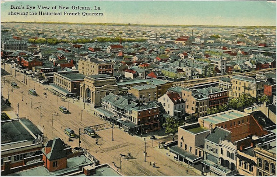
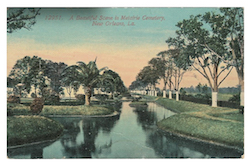
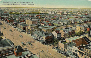 Bird’s eye postcards—just like the bird’s eye maps that inspired them—provide an overview of all or parts of the city.
.
.
.
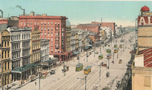
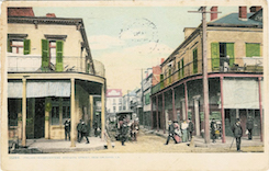 Streetscapes give you an idea of a manageable landscape, including these Italian Headquarters.
.
.
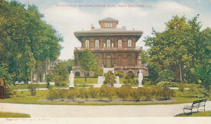 Blocks & Buildings. New Orleans has always been renowned for glorious residences (like this one on Esplanade Avenue), many of which were built on entire city blocks.
.
.
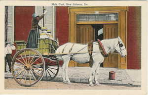 People, Places, & Things—I’ve always wanted to put this milk seller (and the carefree boy in the boater leaning against an electrical pole) into one of my stories, but just haven’t found the right place for either of them yet.
.
How to use your postcards creatively
I’ve studied each of my postcards, often with a jeweler’s loupe, for clues about life in New Orleans. The details abound—the blue and white striped awnings in the French Quarter, the statues on the lawn, the canals and palm tress in the cemetery, the six lanes of traffic on Canal Street—and go into my scenes, chapters, and stories about New Orleans.
And I always read the Message and Address on the postcard back in hopes of coming across something useable. Should I change a character’s name to “Mrs. Lottie Ulrich?” How about “Mrs. Edgar R. Patterson?” Or should I address each married woman character as “Mrs.” more often?
And what writer isn’t intrigued by these postcard messages?
After a haircut-shave, shampoo and massage I looked so young I immediately started for Chicago. I did enjoy your visit so and can’t thank you enough.
I’m here [in New Orleans] and feeling fine as silk.
Another week and I’ll be eating real grub.
The voices of the past make the entire city feel alive to me. And hopefully that translates in my writing.
I enjoy my New Orleans postcard images so much that I’ve integrated them into blog posts and my website. I’ve also used them as swag (I give away reproduced postcards instead of bookmarks) and as book club show-and-tell.
For anyone interested in Turn-of-the-Century urban American, I cannot recommend postcards of the era enough!
I hope you have the opportunity to wander through a box of old postcards someday soon. Just find one postcard that delights you, hold-it-in-your-hand, and let the images and words of the past perform their magic.
*****
 A big thanks to Ana Brazil! She’ll give away a packet of four reproduction postcards and one original postcard of Italian Headquarters, plus a paperback copy of Fanny Newcomb and the Irish Channel Ripper, to someone who contributes a comment on my blog this week (available Tuesday 4 February). I’ll choose the winner from among those who comment by Friday at 6 p.m. ET. Delivery is available in the US only.
**********
Did you like what you read? Learn about downloads, discounts, and special offers from Relevant History authors and Suzanne Adair. Join Suzanne Adair’s Patreon, and subscribe to her free newsletter.